Many informations about COVID-19, CORONAVIRUS, how will it spread into population
in many countries, actual COVID-19, CORONAVIRUS GRAPHS, also Perspectives, forecasts, outlooks for the future, epidemic and pandemic prognosis and actual
>>>>>> COVID-19, CORONAVIRUS PREDICTIONS <<<<<<
COVID-19, CORONAVIRUS links to GRAPHS day by day
COVID-19, CORONAVIRUS links to PREDICTIONS day by day
Other interesting COVID-19, CORONAVIRUS summary links and reference pages


Works performed for:
(certifiable theory)
Crop circles GPS
Crop Circles, Crop figures, GPS Database

Long quotations (considerably more than only a few sentences) from domain cropcirclesonline.com also translated to any language, would be better publish anywhere with author's permission. Thanks.
Also copyrighted photographs ©cropcirclesonline.com ©quick spigots
Citations allowed, certainly. Name source, please. Also link where possible, thx.
Contact cropcirclesonline@gmail.com or lightningsymbols(at)hotmail.com
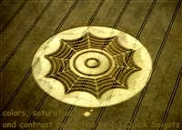
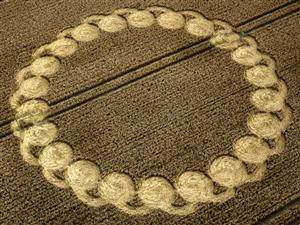
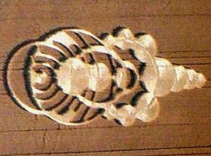
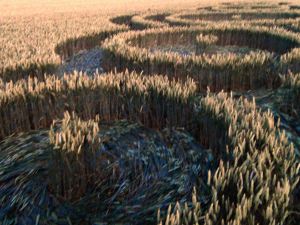
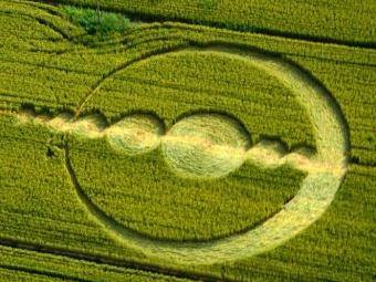
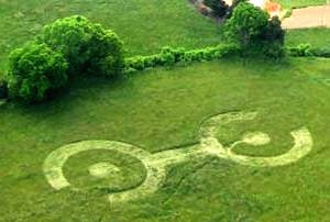
(photo icon also links to detailed page)The latest and last crop circle of 2013 season
| 2013-12-30 | USA | Chualar farm, Salinas, CA | 36.584871,-121.473678 | detail |
|
If interested, contact cropcirclesonline@gmail.com
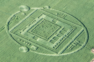
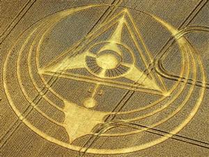
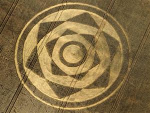
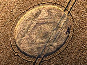
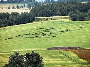
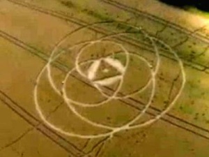
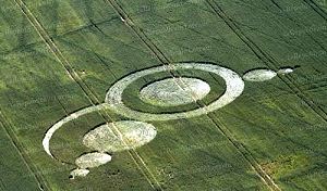
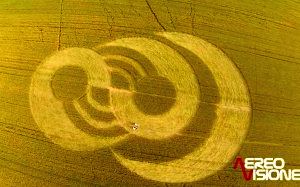
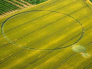
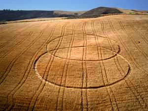
(photo icons also link to detailed pages)Crop Circles 2013 - England
Hover the pointer over the icon in the photo column to enlarge it. Click to visit much more detailed page of that particular crop circle, more photos, larger, some other notes, explanation details. The link from the GPS column points exactly to that location in Google Maps. Later also mounted model into Google Earth base photo surface.
| date | locality | GPS coordinates | note | links | photo |
| 2013-08-13 | Hackpen-Hill | 51.475538, -1.812867 | 1 |
| |
| 2013-08-13 | West Kennett | 51.408582, -1.849042 | 1 |
| |
| 2013-08-12 | Harewell Lane | 52.108429, -2.138432 | 1 |
| |
| 2013-08-11 | Hackpen Hill | 51.47561, -1.819528 | 1 |
| |
| 2013-08-10 | Chute Causeway | 51.313447, -1.586666 | 1 |
| |
| 2013-08-08 | Silbury Hill | 51.408984, -1.85947 | 1 |
| |
| 2013-08-06 | Monument Hill | 51.341557, -1.960663 | 1 |
| |
| 2013-08-01 | Stonehenge | 51.173034, -1.827039 | 1 |
| |
| 2013-08-01 | Roundway Hill | GPS unknown, cut | 1 |
| |
| 2013-08-01 | Milk Hill | 51.367775, -1.84796 | 1 |
| |
| 2013-07-31 | Gripp Patch | 51.31059, -1.883837 | 1, 2, 3 |
| |
| 2013-07-28 | LimeKiln-Wood | 52.689103, -2.515431 | 1 |
| |
| 2013-07-24 | Roundway | 51.384832, -1.995748 | 1, 2, 3, 4 |
| |
| 2013-07-22 | Giant's Grave | 51.365657, -1.763375 | 1, 2 |
| |
| 2013-07-16 | Hilcott | 51.322187, -1.846735 | 1, 2, 3, 4 |
| |
| 2013-07-15 | All Cannings | 51.350868, -1.863373 | 1, 2, 3, 4 |
| |
| 2013-07-15 | Hackpen Hill | 51.478233, -1.810776 | 1, 2. 3 |
| |
| 2013-07-13 | Evesham | 52.127207, -1.844499 | 1, 2. 3 |
| |
| 2013-07-08 | West Overton Hill | 51.402957, -1.803606 | cut | 1, 2 |
|
| 2013-07-07 | Avebury Trusloe | 51.419976, -1.865192 | 1, 2, 3, 4 |
| |
| 2013-07-07 | Milk Hill | 51.36970, -1.853649 | cut | 1 |
|
| 2013-07-06 | Broad Hinton | 51.513782, -1.821020 | 1, 2 |
| |
| 2013-07-06 | Ridgeway | 51.426399, -1.827422 | 1, 2, 3, 4 |
| |
| 2013-06-25 | Silbury Hill | 51.41318, -1.860981 | 1, 2, 3, 4 |
| |
| 2013-06-25 | Windmill Hill | 51.434083, -1.886376 | 1, 2, 3 |
| |
| 2013-06-23 | Horton | 51.367206, -1.947004 | 1, 2, 3 |
| |
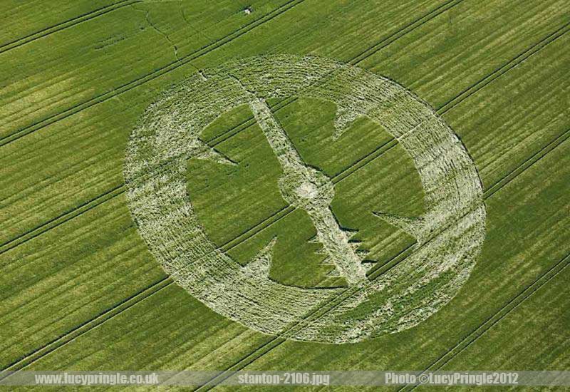
| 2013-06-22 | Stanton St.B. - 2 | 51.363470, -1.860257 | 1, 2, 3 |
| |
| 2013-06-21 | Stanton St.Bernard | 51.363470, -1.860257 | 1, 2 |
| |
| 2013-06-21 | Yatesbury | 51.438412, -1.909622 | 1, 2, 3 |
| |
| 2013-06-09 | Stanton St.Bernard | 51.36845, -1.859038 | 1, 2 |
| |
| 2013-06-07 | Cherhill | 51.42681, -1.934885 | 1, 2 |
| |
| 2013-06-02 | Alton Priors | 51.36246, -1.837609 | 1, 2, 3, 4 |
|
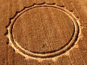
(photo icons also link to detailed pages)Crop Circles 2013 - Czech republic (Slovakia - SK)
Hover the pointer over the icon in the photo column to enlarge it. Click to visit much more detailed page of that particular crop circle, more photos, larger, some other notes, explanation details. The link from the GPS column points exactly to that location in mapy.cz, the link in Note column (GM) points to the same location in Google Maps. Later also mounted model into Google Earth base photo surface.
| date | locality | GPS coordinates | note | links | photo |
| 2013-07-29 | Benesov | 49.763820, 14.718900 | GM | 1 |
|
| 2013-07-28 | Sychrov | 50.631636, 15.113899 | GM | 1 |
|
| 2013-07-22 | Rozsec nad Kunstatem | 49.537691, 16.462380 | GM | 1, 2, 3, 4 |
|
| 2013-07-18 | Rohozna - Osek | 49.306537, 13.963580 | GM | 1, 2 |
|
| 2013-07-18 | Drnovice | 49.476424, 16.545619 | GM | 1 |
|
| 2013-07-14 | Lipnik - Tlmace (SK) | 48.293114, 18.523069 | GM | 1, 2 |

|
| 2013-07-11 | Ustek | 50.593803, 14.364988 | GM | 1, 2 |
|
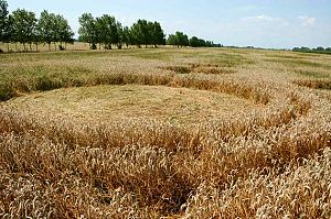
(photo icons also link to detailed pages)Crop Circles 2013 - other countries
| date | country | locality | GPS coordinates | note | links | photo |
| 2013-08-08 | Russia | unknown | --- |
 | ||
| 2013-08-07 | Netherland | Hoeven | 51.627928, 4.569550 | 1 |
| |
| 2013-07-30 | Netherland | Standdaarbuiten, Oudenbosch | 51.635493, 4.549711 | 1 |
|
|
| 2013-07-29 | Netherland | Stadskanaal, Groningen | 53.001674, 6.966049 | 1 |
| |
| 2013-07-28 | Germany | Haunsheim | 48.591040, 10.372924 | 1 |
| |
| 2013-07-23 | Poland | Wylatowo | 52.595531, 17.975832 | 1 |
| |
| 2013-07-21 | Belgium | Rue Lenoir, North East Momalle | 50.692097, 5.363797 | 1, 2 |
| |
| 2013-07-16 | Slovenia | Pecarovci, Pomurska | 46.740326, 16.133967 | 1, 2 |
| |
| 2013-07-04 | France | Imling near Sarrebourg | 48.717969, 7.006732 | 1 |
| |
| 2013-07-03 | Italy | Bienate, nr Milan, Lombardia | 45.577054, 8.831225 | 1, 2, 3, 4 |
| |
| 2013-07-03 | Switzerland | Rheinau, Nr Zurich | 47.643792, 8.630853 | 1, 2 |
| |
| 2013-07-01 | Italy | Brignano (Bergamo) | 45.540470, 9.664001 | 1 |
| |
| 2013-06-30 | Italy | Cavallo Grigio, Robella, Asti | 45.089147, 8.104256 | 1, 2, 3, 4 |

| |
| 2013-06-17 | Russia | Timashevsk, Krasnodar | 45.626667, 39.057778 | 1 |
| |
| 2013-06-09 | Italy | Finale Emilia (Modena) | 44.825583, 11.293389 | 1, 2, 3 |
| |
| 2013-06-08 | Italy | Cava Manara (Pavia) | 45.106221, 9.110326 | 1, 2, 3 |
| |
| 2013-06-06 | Italy | Barbiano Cotignola, nr Ravenna | 44.379637, 11.880791 | 1, 2, 3, 4 |
| |
| 2013-05-22 | Italy | Palazzo, San Gervasio | 40.939304, 15.974997 | 1, 2, 3, 4 |
| |
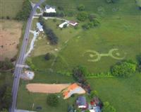
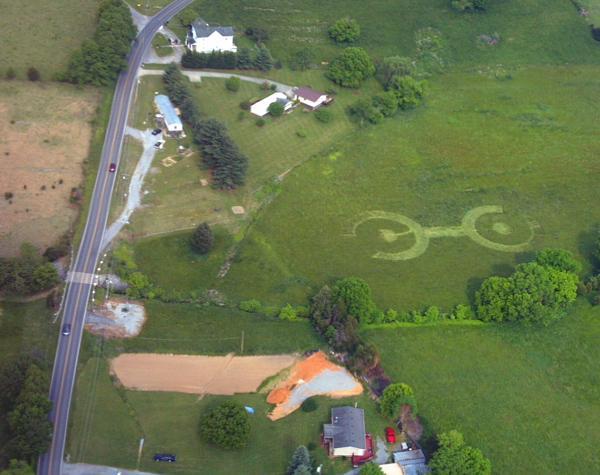
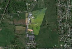
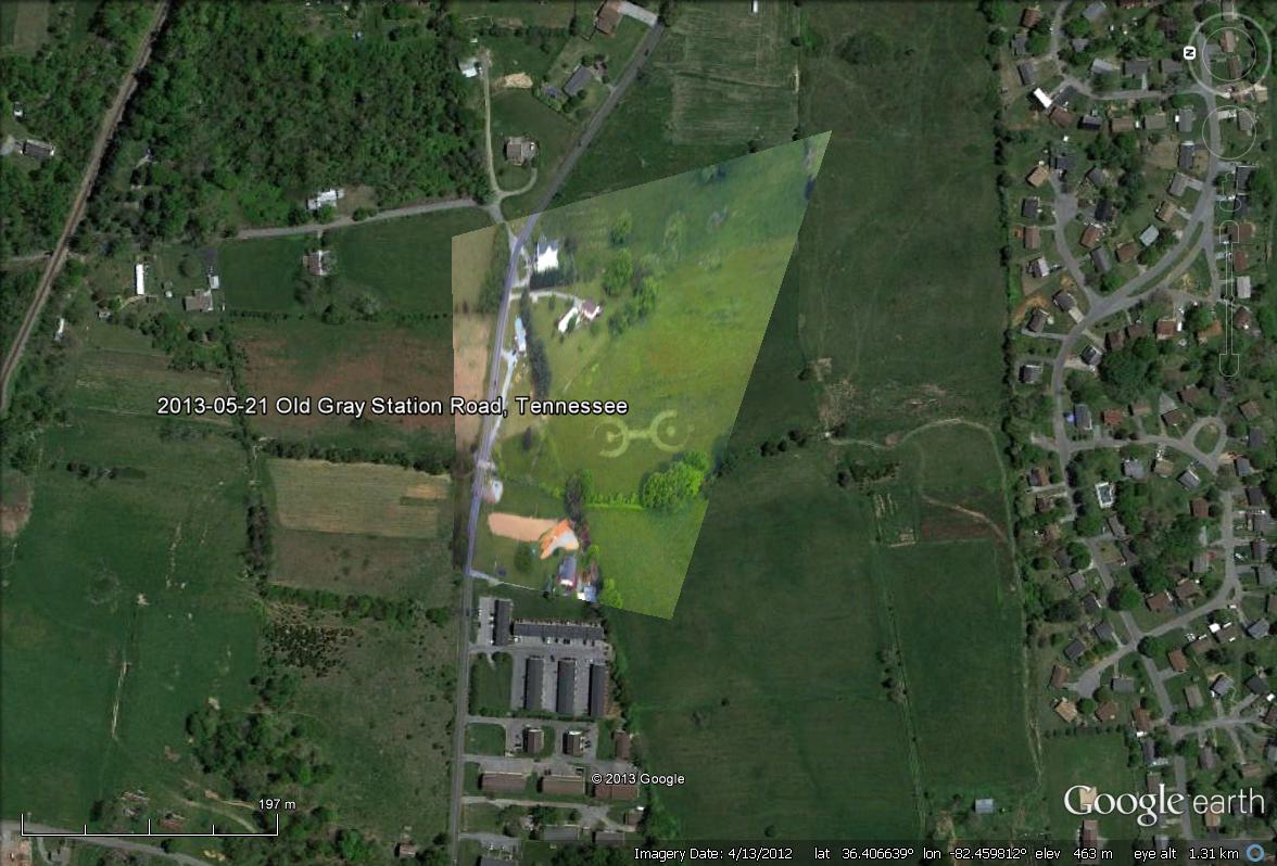
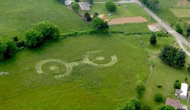
| 2013-05-21 | USA | Old Gray Station Road, TN | 36.40662, -82.459799 | 1, 2 |
| |
| 2013-06-16 | Italy | Enna, Sicily | 1, 2, 3 |
| ||
| 2013-06-20 | Italy | Cisterna, Latina | 1 |
| ||
| 2013-07-09 | Russia | Amber Michurinsky, Krasnodar | 1 |
|
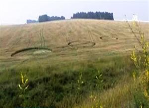
2013 - first crop circle - Tennessee, Old Gray Station Road, 21th of May
England 2012
| date | locality | GPS coordinates | note | links |
| 2012-04-18 | West Overton Hill | 51.399225, -1.820210 | ||
| 2012-04-28 | Yarnbury Castle | 51.158004, -1.947400 | ||
| 2012-05-12 | Water Eaton | 51.636231, -1.799753 | ||
| 2012-05-13 | Hannington | 51.635018, -1.783682 | ||
| 2012-05-19 | Uffington | 51.583987, -1.568685 | ||
| 2012-06-02 | Manton | 51.407218, -1.758015 | ||
| 2012-06-09 | Woodborough Hill | 51.349383, -1.831252 | ||
| 2012-06-12 | Silbury Hill | 51.412904, -1.861295 | ||
| 2012-06-13 | Silbury Hill | 51.410727, -1.865106 | ||
| 2012-06-17 | Frome | 51.243456, -2.288508 | ||
| 2012-06-17 | Telford | 52.665854, -2.533093 | ||
| 2012-06-20 | Golden Ball Hill | 51.369785, -1.821347 | ||
| 2012-06-20 | Oare | 51.371293, -1.777156 | ||
| 2012-06-20 | Telford | 52.662439, -2.516057 | ||
| 2012-06-25 | Adams Grave | 51.365144, -1.846539 | ||
| 2012-06-25 | Cherhill | 51.426096, -1.936453 | ||
| 2012-06-26 | Beckhampton | 51.424796, -1.900557 | ||
| 2012-06-26 | Stanton St Bernard | 51.365009, -1.865888 | ||
| 2012-06-29 | Stanton St Bernard | 51.357999, -1.860564 | ||
| 2012-07-01 | Avebury | 51.421208, -1.851309 | ||
| 2012-07-01 | Telford 1 | 52.677849, -2.498674 | ||
| 2012-07-01 | Chilcomb Down | 51.058472, -1.258874 | ||
| 2012-07-01, 21 | Foxhill | 51.526023, -1.673257 | ||
| 2012-07-05 | Westwoods | 51.393604, -1.808456 | ||
| 2012-07-09 | Picked Hill | 51.348792, -1.819201 | ||
| 2012-07-11 | Corley | 52.463013, -1.553080 | ||
| 2012-07-12 | Etchilhampton Hill | 51.340935, -1.951066 | ||
| 2012-07-16 | Stanton St Bernard | 51.358835, -1.860664 | ||
| 2012-07-17 | Yatesbury | 51.436943, -1.927957 | ||
| 2012-07-21 | Foxhill | 51.526023, -1.673257 | ||
| 2012-07-21 | Telford | 52.678795, -2.554533 | ||
| 2012-07-21 | Telford | 52.678795, -2.554182 | ||
| 2012-07-22 | Aldbourne | 51.484502, -1.625874 | ||
| 2012-07-23 | Longwood Warren | 51.041394, -1.230940 | ||
| 2012-07-24 | Allington | 51.373895, -1.895555 | ||
| 2012-07-24 | Bishops Cannings Down | 51.396853, -1.928215 | ||
| 2012-07-25 | Hinton Parva | 51.531769, -1.657884 | ||
| 2012-07-25 | Windmill Hill | 51.432562, -1.871350 | ||
| 2012-07-26 | Olivers Castle | 51.382589, -1.990147 | ||
| 2012-07-26 | West Overton Hill | 51.398237, -1.813616 | ||
| 2012-07-28 | Etchilhampton Hill | 51.349046, -1.957100 | ||
| 2012-07-28 | Hannington | 51.628794, -1.746702 | ||
| 2012-07-29 | Allington | 51.373034, -1.902861 | ||
| 2012-07-29 | Ogbourne St George | 51.469981, -1.765656 | ||
| 2012-07-29 | Owlesbury | 51.022209, -1.263539 | ||
| 2012-07-31 | Windmill Hill | 51.438008, -1.872674 | ||
| 2012-08-01 | Avebury | 51.431103, -1.850309 | ||
| 2012-08-02 | Martinsell Hill | 51.380176, -1.729049 | ||
| 2012-08-04 | Coventry | 52.427849, -1.588974 | ||
| 2012-08-05 | Milk Hill | 51.371408, -1.866359 | ||
| 2012-08-05 | Owslebury | 51.014259, -1.248778 | ||
| 2012-08-08 | Roundway | 51.373939, -1.978523 | ||
| 2012-08-09 | Cheesefoot Head | 51.046668, -1.244090 | ||
| 2012-08-09 | Cheesefoot Head | 51.046000, -1.242720 | ||
| 2012-08-11 | Bishops Cannings | 51.383000, -1.956939 | ||
| 2012-08-11 | Malmesbury | 51.588427, -2.065260 | ||
| 2012-08-12 | Devils Den | 51.425249, -1.783724 | ||
| 2012-08-14 | Uffington | 51.581599, -1.568416 | ||
| 2012-08-15 | Leamington Spa | 52.327829, -1.454541 | ||
| 2012-08-18 | Leamington Spa | 52.269487, -1.476190 | ||
| 2012-08-19 | Furze Hill | 51.392620, -1.825634 | ||
| 2012-08-20 | Woodborough Hill | 51.351320, -1.826404 | ||
| 2012-08-21 | Barnsley | 53.544559, -1.542050 | ||
| 2012-08-21 | Furze Hill | 51.384571, -1.823612 | ||
| 2012-08-21 | Hackpen Hill | 51.472769, -1.812595 | ||
| 2012-08-21 | Hackpen Hill | 51.469310, -1.813790 | ||
| 2012-08-23 | Savernake Forest | 51.416759, -1.670905 | ||
| 2012-08-26 | Hackpen Hill | 51.477098, -1.820147 | ||
| 2012-08-30 | All Cannings | 51.359906, -1.892636 | ||
| 2012-09-05 | Ridgeway | 51.418585, -1.829223 | ||
| 2012-09-07 | Rochford | 51.568483, 0.723184 |
England 2011
| date | locality | GPS coordinates | note | links |
| 2011-04-22 | Chepstow | 51.619512, -2.681747 | ||
| 2011-04-27 | Adams Grave | 51.367915, -1.845396 | ||
| 2011-04-29 | Silbury Hil | 51.412588, -1.862439 | ||
| 2011-05-07 | Hannington | 51.632938, -1.780205 | ||
| 2011-05-07 | Hannington | 51.632383, -1.786146 | ||
| 2011-05-16 | Winchester | 51.050769, -1.356296 | ||
| 2011-05-17 | Winchester | 51.051292, -1.355328 | ||
| 2011-05-17 | West Kennett | 51.407231, -1.843534 | ||
| 2011-05-21 | Barbury Castle | 51.491672, -1.763674 | ||
| 2011-05-28 | Ridgeway | 51.417268, -1.832748 | ||
| 2011-05-30 | Hackpen Hill | 51.479425, -1.838537 | ||
| 2011-06-01 | Wilton Windmill | 51.352499, -1.602154 | ||
| 2011-06-09 | Ashbury | 51.557858, -1.602067 | ||
| 2011-06-18 | King's Somborne | 51.080447, -1.488987 | ||
| 2011-06-18 | Worlaby | 53.268897, 0.000998 | ||
| 2011-06-20 | Coberley | 51.846606, -2.031315 | ||
| 2011-06-20 | Stonehenge | 51.178882, -1.861579 | ||
| 2011-06-21 | Stonehenge | 51.183809, -1.864146 | ||
| 2011-06-21 | Westwoods | 51.391990, -1.812247 | ||
| 2011-06-21 | Stanton St Bernard | 51.365980, -1.865555 | ||
| 2011-06-22 | West Kennett | 51.407231, -1.843534 | ||
| 2011-06-22 | East Field | 51.361052, -1.830651 | ||
| 2011-06-25 | Beelsby 1 | 53.504977, -0.157369 | ||
| 2011-06-26 | Beelsby 2 | 53.504138, -0.154665 | ||
| 2011-06-26 | Stanton St Bernhard | 51.355402, -1.859456 | ||
| 2011-06-27 | Chicklade | 51.117082, -2.075928 | ||
| 2011-06-28 | Allington | 51.371303, -1.895931 | ||
| 2011-06-28 | Allington | 51.359118, -1.914977 | ||
| 2011-06-29 | Hinton Parva | 51.537080, -1.649907 | ||
| 2011-07-02 | Barbury Castle | 51.489881, -1.767808 | ||
| 2011-07-03 | Walmsgate | 53.290045, 0.041681 | ||
| 2011-07-04 | Stanton St Bernard | 51.350626, -1.862498 | ||
| 2011-07-04,6 | Stanton St Bernhard | 51.353973, -1.862546, | ||
| 2011-07-06,8 | Milk Hill | 51.369572, -1.853397 | ||
| 2011-07-11 | All Cannings | 51.360149, -1.884716 | ||
| 2011-07-13 | Windmill Hill | 51.435452, -1.871335 | ||
| 2011-07-13 | Lane End | 51.036926, -1.218858 | ||
| 2011-07-13 | Stonehenge | 51.176025, -1.825924 | ||
| 2011-07-13 | Mere | 51.105198, -2.216442 | ||
| 2011-07-18 | Ridgeway | 51.430005, -1.821945 | ||
| 2011-07-20 | Louth | 53.323310, -0.054848 | ||
| 2011-07-20 | Hinton Parva | 51.531119, -1.652208 | ||
| 2011-07-20 | Beckhampton | 51.422705, -1.903227 | ||
| 2011-07-22 | Temple Balsall | 52.369577, -1.691946 | ||
| 2011-07-22 | East Kennett | 51.404506, -1.841364 | ||
| 2011-07-23 | Roundway Hill | 51.378186, -1.976438 | ||
| 2011-07-24 | Waylands Smithy | 51.563711, -1.590474 | ||
| 2011-07-25 | Etchilhampton Hill | 51.345311, -1.956724 | ||
| 2011-07-25 | Roundway | 51.374955, -1.976260 | ||
| 2011-06-25 | West Kennet Long Barrow | 51.410024, -1.848959 | ||
| 2011-07-26 | East Field | 51.360201, -1.829980 | ||
| 2011-07-26 | Windmill Hill | 51.436338, -1.882095 | ||
| 2011-07-27 | Cherhill | 51.426609, -1.935199 | ||
| 2011-07-27 | Chirton | 51.304052, -1.897235 | ||
| 2011-07-29 | Inkpen | 51.357128, -1.454146 | ||
| 2011-08-02 | Avebury Trusloe | 51.420804, -1.863287 | ||
| 2011-08-04 | Waylands Smithy | 51.570973, -1.588136 | ||
| 2011-08-04 | Bishops Cannings | 51.368452, -1.950026 | ||
| 2011-08-06 | Morgans Hill | 51.394355, -1.952524 | ||
| 2011-08-07 | Marlborough Downs | 51.445721, -1.795525 | ||
| 2011-08-10 | Giants Grave | 51.364380, -1.766319 | ||
| 2011-08-12 | Beckhampton | 51.424330, -1.896551 | ||
| 2011-08-12 | Yatesbury | 51.428400, -1.897675 | ||
| 2011-08-15 | Cherhill | 51.436587, -1.939544 | ||
| 2011-08-28 | Alnwick | 55.407430, -1.656978 | ||
| 2011-10-07 | East Field | 51.364218, -1.831500 | ||
| 2011-12-08 | Roundway Hill | 51.379811, -1.979056 |
Currently only a few examples, over time will continually grow more..
.jpg)
.jpg)
.jpg)
Some important notes
We can only thank once again to the explorers of mysterious patterns - crop circles - Cerchi nel grano - from Italy, who are perhaps the first and only ones in the world, able to take care about entirely irregular shapes, as well as finding out the specific connection.
On this page will be gradually published details of large amounts (80-90%) crop circles that have been found in the whole world, not just in Britain. At random, from some other countries - the Netherlands, Sweden, Norway, USA, Germany, Italy, Finland, Czech Republic - Slovakia and many others. Will be gradually placed data on individual occurrences from the uttermost years to the present.
The most from England, of course, those are collected already over a thousand. From the other countries should only scattered specimens (Norway, Sweden), as well as many dozens (Italy), or nearly two hundred specimens (Germany)
Here on this page or the links will be placed primarily locale name and date where the pattern was found. Continuing, of course, GPS data, and a link to Google Earth (*. kml, *. kmz), which leads directly to the the observers place where the pattern occurred. In addition, it can show some more details - the most famous photographs, links to published pages.
In some cases will be displayed a little miniature of the pattern, with basic data, thumbnails with links to the most known published photos. Some links will directly place an approximate shape (model) of the shape into the point of occurrence, according to the informations, available about the crop circle location and orientation.
This is quite clearly the most comprehensive database of Crop Circles GPS (proven), found around the whole world, that will be published ever. Yet to be published in a simpler form, only name, date, GPS. Also maybe + some interesting links.
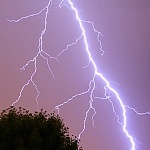
Among other things: insightful individuals (there are not many of them inside you, dear mankind, but here and there some exist) certainly through the observation of particular localities and local conditions, particularly through Google Earth, reach surely to believe that the natural way of explanation of crop circles by the lightning discharge is the only one possible. Local natural and artificial lightning rods - trees, shrubs, power poles. Some crop circles may be found on the photographic map backgrounds from different years, as well as irregularly lodged crop areas, near and farther away. They are quite inseparably accompanying them, and arise from exactly the same cause like crop circles - as the consequences of electricity from lightning discharges. Mostly in the Google Earth - there exist a possibility to display pictures from different years.
This page was prepared, and all the facts and theories presented here were very thoroughly, closely and in detail experimentally examined by
Jan Ledecky